Wednesday, November 23, 2011
Accidents, Burlington, and Concerts: The ABC's of my weekend...

But not in that order...
As a few of my faithful readers know (Hi Cory!), I went to Burlington, VT for a few days to celebrate my... the...well, just to celebrate really.
 |
| That's Cory up there ^ |
The whole thing was inspired by a Phantogram concert at Higher Ground. I've seen 3 shows there, and the artists always seem to really enjoy the scene. Exitmusic opened the show with a chill and melodic blend of post-rock and pop. In other words, fine music for listening to while reading a book, but not the kind of stuff that will get you pumped for the rest of a concert.
Fortunately, Phantogram brought it back with some pretty incredible beat drops. Their best song live is without a doubt Futuristic Casket, and When I'm small takes a close second. The best part of the show was finding out we had stumbled on the last show they plan on playing in quite some time. Oh, and it was 13 bucks!
Most of my time in Burlington was spent catching up with friends, but Cory opted to multi-task, so we went for a hike to Milton Falls.
 |
| Looking down the left channel. The little bit of spray under the sun glare is the part that has been run. Check out the rocks it lands on! |
 |
| Another view of the falls that's been run |
 |
| Looking up the Right Channel |
 |
| Looking up at the Left Channel from the island in the center. |
The first time I'd heard of this place was from Scott Gilbert who has a photo with probably 20 times the flow shown here. Seriously.
This huge set of cascades is just north of Milton and can be accessed by turning off Rt. 7 onto Ritchie Ave. There's a small gravel lot about halfway down the hill with a lookout over a small piece of the falls. Better views can be accessed by canoe or kayak by driving another 0.2 miles and launching into the pool there.
The following day I finished my novel for nanowrimo, although that's using "finish" rather loosely. I hit the target word count and the whole story line is completed, but no editing or revision has been done. If anyone wants to take a look and put in some serious editing time, drop me a line!
When I decided to head home, Winter struck.
 |
| Seriously? |
Between 11 pm Tuesday night and 6 am Wednesday morning, 4-5 inches of snow fell in Burlington. Snow continued to fall as I drove south behind a line of flashing redlights as far as the eye could see. Tractor Trailers were stuck on hills, snowplows hadn't been out yet, and a slippery layer of extra wet snow was on the pavement beneath the ever accumulating snow. I was going 10 mph, and I WAS GRIPPED.
Not only were there Massachusetts license plates both in front and behind me, I also didn't want to come to a complete stop because my poor front wheel drive car probably wasn't going to be able to regain the momentum necessary to start moving back up that slick hill. I mean, I was in Vermont after all...
Roads improved greatly in NY, although only briefly. I dismissed my better judgement which was fearfully pleading me to take the roads that weren't covered in snow and didn't go through the mountains. Instead, that's exactly what I aimed for for these important reasons:
- Re-routing would cost a lot of gas money.
- Re-routing would be really boring.
- And most importantly, driving on terrible roads in the middle of the mountains sounded like an adventure, and I love adventures!
 |
| Yup, sketchy roads were definitely worth it... |
 |
| How can Better Judgement compete with views like this? |
Well, as promised, there is an accident in this story. Suffice it to say that I got a little too pleased with myself about defeating Better Judgement. Taking this route almost seemed like it was better than Better Judgement. That's right, we're talking about Best Judgement.
Unfortunately, that's the common disguise of Bad Judgement, and the little voice I thought was Best Judgement told me that I didn't need to slow down too much for the turn that had a suggested speed of 35. In fact, if I just slipped into the other lane for a second I wouldn't need to brake at all.
Well, that worked out great, but what I forgot was that turns can come in pairs (sometimes more, but that's not important). So even though I sailed through that first turn perfectly in control and without needing to brake, I was approaching the next one a little too quickly for my taste.
Now at this point there was probably 2 inches of fresh snow on the road and another 10 in places unplowed. Such a layering of snow is not conducive to stopping on short notice, nor is it conducive to maintaining traction in a sharp turn.
As the tires locked up, I also noticed the oncoming snowplow that would soon be entering the same turn. At this moment, I recognized that Best Judgement was indeed an impostor.
Fortunately, I ended up in the ditch. This was preferable to being the snowplow's new hood ornament, and also better than skipping the ditch and hitting the giant boulders just beyond. By the time the snowplow stopped, the logging truck behind me had caught up and also got out. They spent a brief moment good-naturedly chiding me, then talked about the rather large number of other vehicles that have gone off the road in that exact spot, and then mentioned that they could help me out. I was happy to wait for them to finish their chat before they decided on this. Besides, it's not like I was going anywhere.
The (very nice, super awesome) trucker dude tied a giant piece of webbing to his truck while I hooked it onto the convenient eyelet in the back of my car and he dragged me out. I thanked him and continued on my merry Thankful way. It was the day before thanksgiving, after all.
I stopped for a quick hike up Bald Mountain, between Inlet and Old Forge.
 |
| The Topo Map was a little hard to read... |
And as soon as I passed Old Forge the roads were bare. Which is better than the roads being Bear.
 |
| They were a little foggy though... |
Happy Thanksgiving everyone!
This year I'm thankful for truckers and chains!
(and of course all you readers out there as well)
Labels:
2011,
Adirondacks,
Bald Mountain,
Burlington,
Falls,
Hiking,
Milton Falls,
New York,
Thanksgiving,
Vermont
|
 3
comments
3
comments
3
comments
Wednesday, November 16, 2011
On First Descents and Exploring Locally...
In an interview with Jeff McIntyre of In Between Swims, Doug Ammons says "It's going to become perhaps more local, but there's an infinite number of other [first] descents."
Whether you're still figuring out your roll, running class 3 for the first time, or a seasoned paddler with a few of your own, you've probably at least heard the term First Descent. It's the subject of dreams for some, and a source of much contention on message boards and around campfires.
Simply defined for our purposes, a First Descent is a river or drop that no one has ever paddled before. I was one of those who dreamt (and still do) about paddling such a river, although now the dreams are of the next one.
 |
| Taylor Krammen after a successful descent of One Whistle Falls on Upper Roaring Brook. We believe this is a first descent, but welcome contesters. |
These rivers are, by their very nature, mysterious. They add an expeditionary feel to the undertaking; little things like where to set safety and finding ways to scout become incredibly important. It's never easy to tell if you actually are the first paddler to slip between the gorge walls or emerge at the base of a waterfall unharmed. Many of the iconic pioneers of our sport made several first descents and never told a soul. Sometimes they ran all the rapids, sometimes they walked everything but the flat water. Some even did this solo.
So it's hard to say when attaching a name to this "First Descent" became important or what even qualifies as a true "Descent." Personally, if someone is going to claim a first descent, I'd like to see at least half of the runnable drops being run, but that's purely conjecture, and I encourage you to develop your own opinions. Ant this is the exact reason the "FD" words are such a hot term in the kayaking community. Everyone has their own opinions on what it means, and more importantly, there's always some old codger who is way better than we are that seems to know someone who did it before us. Well, almost always...
To me, a "First Descent" is actually pretty meaningless until you add another word to the phrase: Personal.
Frankly, I don't care if another person has paddled the river before me. The important thing is the experience I get from it and my personal interpretation of that. It seems foolish to get wrapped up on whether or not I was the first one to float down a stream in a big tub of plastic when someone probably took some boots, hammered some nails in the bottom of them, and stood on a log that they just cut down with an axe nearly a century ago as it floated down a river they were pretty sure ended up in town. Yeah, you want to talk about bad ass?
 |
| No, but really... |
So we've got a new phrase: "Personal First Descent."
I like this quite a bit more for several reasons.
First and most importantly, it's more accessible. Finding a river that nobody knows has been run is pretty hard. Finding one that actually hasn't been run is even more difficult. But finding a river you haven't run is probably a lot easier. In fact, there's probably one within an hours drive that you've never even heard of.
Secondly, all the conjecture and uncertainty is dispelled. No one can accuse you of false claims or say that you actually already did do that run. Besides, what difference does it make to them? I mean, really.
Another reason Personal First Descents are great is that they can be done with as much or as little beta as you want. For paddlers trying to get a taste of expeditionary paddling, they can drop in relatively blind with just a glance at a topo map; paddlers just looking for a change of scenery can talk to friends or read trip reports.
And finally, a Personal First Descent can still be a first descent. The best part of a pfd is creating your own definition of success.
All of this builds towards the newest facet of my paddling obsession; exploring locally. Even before I began paddling, I found a deep joy and sense of presence in hiking up streambeds. As I began paddling more, these excursions developed a duality. While I still enjoyed the aesthetic value of the rapids and waterfalls I discovered, I also began noting which spots looked like they would be survivable in a kayak.
 |
| Definitely surviveable. Independence River, NY |
And so began a long-held tradition. I would walk up an obscure riverbed, sometimes taking photos, and store some of what I saw in the back of my mind. I'd do a little research or ask around and drop my jaw when people told me they had run this section or that. Some of them seemed impossible, if not because the whitewater was too difficult, then because it never seemed there would be enough water.
 |
| I mean, let's be real here... |
Then again, I had seen them in the spring when the ground was shaking as tons of water cascaded downhill. Maybe it was possible after all...
 |
| Joiner Brook, VT in the fall floods of 2010 |
Or maybe the rivers seemed too far off, encased in a roadless valley somewhere far from civilization. Boats are heavy, who would want to carry them 12 miles into the mountains? Oh, right...I would.
 Scott Martin and I spent some time in Northern PA last weekend specifically to find some PFDs. They may not all be unrun, but there are definitely some good ones. And they're all PFD's too.
We checked out most of the tributaries to Rock Run, a local classic that I have yet to do. Scott seems to be the Rock Run liaison for those of us to the North, so if there's water, he'd be a good guy to contact.
The plus side to scouting the tributaries here is the gorgeous scenery, which has led several publications refer to it as "The Prettiest Stream in Pennsylvania."
 |
| Scott doing his photography thing... |
 |
| Scott taking a peak at our "little" secret. |
It's amazing what you can find in your own back yard. A friend of mine put together this short video full of rivers we believe hadn't been paddled before. Best of all, they were all within about an hour from my house. Of course, if they have been paddled, I'd love to swap stories about our experiences.
So here's to first descents, personal or otherwise...
 |
| That one at the bottom is ~30 ft, for scale. About 5 miles South of Lowville, NY. |
Now get out there and explore your backyard!
Labels:
Brokeback Gorge,
First Descent,
Kayaking,
New York,
Pennsylvania,
Rock Run,
Scott Martin,
Scouting,
Whitewater
|
0
comments
0
comments
Tuesday, November 8, 2011
Double Whammy!
 |
| Tandem bridge walking, it's that big... |
Two rather big developments in this post:
1. I finally broke my first paddle
2. I've reached the halfway point of my novel.
So first, let me just say that I've had my $170 AT for 3-4 years now. I can't say that I intentionally mistreated it, but I certainly didn't baby it either. But hey, everyone uses their paddle as a baseball bat every once in a while, right? ....right?
Ok, so I didn't ever do that, but I did toss it on shore, use it as a depth meter, and crank really huge boofs with it.
 |
| Even when boofing might not be advised... -Brian Murphy Photo |
As those of you who have paddled with me know, it was really only a matter of time. The blades had been worn down at least an inch on the edges, and sometime last summer it started sinking in the water. It had a lovely tendency to fill with water and then leak out on dry clothes. At some point I had this fixed with a little duct tape, but at Gauleyfest this year the problem returned. I noticed a little more flex than usual and began avoiding more committing runs (except the Oswegatchie, that's just too good to miss). In the end though, it happened on one of the rivers that gave it the most abuse.
 |
| Ahh, Fowlersville, moments before the break. |
The paddle finally gave out on the Bottom Moose. It more or less folded at the joint on impact at Fowlersville. In this case, I think the tuck did more harm than my typical plug, but I guess we'll never know. Either way, I was glad it happened here instead of further down. For one, I was closer to the cars so I could drive shuttle if necessary, and two, I wasn't halfway down Powerline or Crystal trying to C1.
 |
| Not so tasty... Note the "reshaped" blades... |
Fortunately for me, Jim was too lazy to take his breakdown out of his boat from our last paddling trip, and he had it assembled by the time I could hand off my broken paddle. It flexed a lot, but at this point it probably had more surface area on the blades than mine did. I finished out the day enjoying the unseasonably late warmth with good friends and a few new ones.
 |
| One of my favorite views from one of my favorite rapids. With my favorite breakdown paddle, for that matter, too. Crystal, Bottom Moose |
Ok, now for the boring part.
I just reached the halfway point in my novel, and because all of you are such faithful readers, you get a little sneak peak, inspired by the Moose!
Cobb was already sliding before he realized what Sam had talked him into doing. He had nodded and smiled and laughed his way up the steep slope to the narrow plateau and tightened the back of his seat so he was snug in the bright plastic. And now he was flying down the ocean of pine needles, rocketing through the gauntlet of tree trunks. He leaned forward and reached across the bow of his boat, minimizing the surface area left to slam into a tree branch. He breathed the soft scent of crushed pine needles. The rush of air and soft shifting of plastic along the loamy soil rang in his ears like an orchestra. In a moment, the dusky blur was blasted into a faint memory by the golden sunlight of the open river. He hung in the air for a moment and remembered those cold car rides wishing he could fly.
He landed in the dark, cool water with a slap that brought his focus back into the present. He grinned. He knew that was only the beginning of the day’s excitement. He began paddling downstream, eager for the next rush of color and sound. Sam landed in the water with a whoop and caught up. They were junkies drifting between the small boulders, looking ahead at the edge of the world, their next fix. Treetops and empty space. The black conveyer belt before them flowed onwards, indifferent to the blank space ahead. A yellow leaf drifted listlessly over the edge. Cobb followed, falling, accelerating, disappearing. He popped up in the foam and swirling pieces of driftwood at the bottom and paddled into an eddy. Sam followed soon after, and Cobb counted ten mississippis before he emerged from the grasp of the white noise, grinning. And then they were off again, weaving their laughter between boulders and over more horizons.
Cobb and Sam never once stopped to scout ahead and find the route. This was their run. They had a responsibility to know where the big holes were and at what level the ledges were still ok to paddle. Together they had over 200 runs on this section alone. It was their training grounds. Some might say their confidence was justified. The one rapid that still made Cobb’s heart rise to his throat was Crystal. There was something about that coliseum of sandy-orange rock and the cascading whitewater within it that resonated with his soul. Interacting with something like that never came as easy as he expected. Instead, it created a challenge that left him breathless, unnerved, and wishing it would never end.
I also think the very middle word of the target word count (25,000 of 50,000) being "Rum" is important to mention. Some might say the entire novel centers around alcohol. Based on word counts, they would be correct.
And now the bonus material!
I managed to get outside between the terrible weather, paddling, and writing like a madman. I even got the family to come with. Well, some of them...
We spent some time hiking into a few drops on the West Branch of the Oswegatchie, which looks like a lot of fun, but also has a lot of flatwater. Here are a few shots.


The biggest reasons to try and get along with fishermen:
There are more of them than there are us
They have more influence on access to rivers
They know about lots of sweet waterfalls we might not
 |
| Sweet waterfalls like this... |


I found a piece of ice that looked a lot like Vermont, so I had Nicole snap a picture of me "In" an "Icy VT." The trails were all in really good condition and had some pretty sweet views at the end. They'd make some good picnicking destinations, and they're pretty easy to get to. I found all of them with directions here!

Monday, October 31, 2011
NaNoWriMo
No, it's not the name of the ultra-classic new creek I found in my backyard, although there are plenty of those in the region. Those have much stranger names...
 |
| A local's only classic... |
NaNoWriMo stands for National Novel Writing Month.
Check them out here!
Basically, they encourage writers of all ages and skill levels to write a 50,000 word novel in a month. That's about 175 pages. Since I have approximately zero judgement skills, I've decided to take on this challenge.
Rather than giving away my super awesome plot and letting you all get a sneak peak at the totally original characters, this post is more of an apology for a potential lack of posts over the next month.
I'll be relying heavily on paddling and other outdoors adventures for inspiration/sanity maintenance, so all hope is not lost. I will continue to post as often as I can, but I can't promise my usual frequency.
 |
| Blog posts may be spotty, kinda like the sky here |
If you want to send your support, comments and emails are welcome! You can also accuse me of wasting my time and tell me not to quit my day job. I won't listen, of course, because I don't actually have a day job.
 |
| Getting views like this with day jobs is kinda tough, so I don't mind too much |
Cheerio!
Labels:
Brokeback Gorge,
Burlington,
Camel's Hump,
Novel,
Roaring Brook,
Sunrise,
Sunset,
Writing
|
0
comments
0
comments
Tuesday, October 25, 2011
The Blizzard of OS
So after an awesome Moosefest, the water just stayed up. The Oswegatchie kept rising, and I knew it was going to be awesome on Tuesday, so I sent out a call using a high-tech new device made to contact large groups of people all at once: The Facebook Status.
Invitation in place, I headed out to drive to school, but before I could fasten my seatbelt I got a text from Jim Dobbins asking if I wanted to paddle. Great minds think alike. When I got back, Dave G(n)ardner had also answered the call to stout, arguing "why not today?"
With plans in place, I went to bed dreaming of huge boofs, scary holes, and big drops.
I had only paddled the Os once before, in the spring with Scott Martin and Alan Panebaker. When we went, the gauge was reading crazy high, up at 2230 cfs, so we were a little nervous paddling into the unknown. Luckily, we had the perfect flows, and I couldn't imagine it being nearly as much fun with any less water. You can check out Scott's awesome writeup and photos here! He even got a shot of a scumbag like me in Banks Mag from the trip!
So when the guage read 1800 cfs the on the cold and dismal morning just two days after Moosefest, I was confident that I would be running almost everything. That's not to say that I was going to go in there guns ablazing, but come on, how bad could it be?
Well, there are reasons Jim likes to call it the Out-To-Get-Me. I think the river was doing it's best to seduce me into a false sense of security this spring, because as soon as we got to the takeout I could tell it was high. I mumbled something about taking a look at the West Branch (renowned for it's flatwater), while Jim and Dave were already buckling the belts on their big boy pants. After changing, we rode up the bouncy, rocky, dirt road to the put in in Jim's subaru outback. I sat quietly in back, remembering with a faint sense of irony, that my Hyaundai Accent has significantly less ground clearance than most cars.
At the put in, we once again commented on how high the water was. Dave cheerily added that he had snacks. "Oh good," I thought, "at least I won't die on an empty stomach..."
Truth be told, I wasn't that scared. I new just about everything was pretty easy to walk, but I was definitely a little nervous. We had all done it before, but Uncle Jim was the group veteran, and he did an awesome job guiding us down. Without his verbal beta and quick 1 man scouts, the take-out would have been much darker when we got to it. Dave might have even had to go snuggle with the dog that kept barking at us for warmth, it wouldn't be the first time after all. But that's another story...
 |
| Jim, directing Me following directions |
I ended up walking Nipple Twist Falls, while Dave and Jim both styled it.
 |
| Jim, getting super style-y |
We all ran the entrance drop above Rainbow, but Jim and I managed to tweak our backs pretty good at the end of the slide. As soon as I saw Rainbow I got fired up to kayak such an incredible waterfall again. Still, it was big and intimidating, and I had no problem letting Dave probe. I even took video...
 |
| Dave Gardner, melting into the Rainbow |
After a line like that, I couldn't not run it. I gave Dave and Jim the thumbs up and took a last look at the lead-in and got in my boat. I lined up using the same two curlers I did last time, and not surprisingly, had almost the same line I did last time. I end up getting a half boof off the flake on the right, so next time I think I'll follow Dave's line a little closer and look for a pot of gold at the base of the Rainbow.
 |
| Looking down the barrel.... |
 |
| Half-boof, and sideways. Forgot to mention that part... |
As I rolled into the lip, I felt incredibly calm and ready. I felt like I was where I wanted to be, but at the last second I started getting pulled over to the right side again and just nicked the flake on the right, twisting me sideways. I planted a big brace in there and worked it out, straightening out before impact and resurfacing slightly sideways. It's always a surprisingly soft hit, and surprisingly smooth the whole way down for that matter.
After re-grouping at the base, we cruised the fun gorge below and relaxed in the easier water on the way out to Bryants Bridge. From there starts section 4.
Both sections are roughly equal in length, but characteristically different. Section 3, in my opinion, involves more time spent wondering what's around the corner and navigating cool mini-gorges. Section 3 also has Rainbow Falls, which is a really fun and (seemingly) forgiving big drop.
Section 4 has less consistent whitewater, but more big rapids. There's a bit more flatwater on this stretch, but if you're ready to run the big ones, it packs them in nicely. Sluice Falls offers a great finale for those looking to lose some vertical with a little more challenge than on Rainbow.
 |
| Jim blasting down Section 4 |
I was really surprised with how much different this stretch became with higher water. The holes got significantly more powerful, and I ended up walking some of the drops that I thought were the most fun last time. Fortunately, the river isn't going anywhere.
 |
| Dave giving it to the tooth Ferry. |
Dave did a great job of showing the Toothferry who's boss, and we both took huge hits at the bottom of Panther Falls. Jim probably drank a glass of milk while he watched us, leaving us to damage our spines. While filming at Panther, Dave said I disappeared in the spray and the next time he saw me I was resurfacing 30 feet from the base.
Once again, Uncle Jim led the charge through the blind corners and boat scouted the stuff Dave and I were too scared to run blind. When we got to Sluice, I needed about 30 seconds to decide that there was too much water for me to feel comfortable nailing my line. Jim started the portage, and Dave fought the good fight: Seeing the line, but just not being sure enough, and finally decided to take the sneak (portage).
We ran the final rapids and settled into an easy cadence of paddling and talking for the next 20-30 minutes to the takeout.
 |
| My boat, getting the only bubble bath it will ever see. |
Quote of the day: "I was supposed to do basework today, but I looked at Tom and I said 'No, Tom, I'm not doing basework today. I'm going stouting.' And I packed my stuff, and now we're going stouting!"
And of course, the obligatory video-edit!
Self proclaimed line of the day:
 |
| Trashcan Falls, Sec. 4 -Jim Dobbins Photo |
Monday, October 17, 2011
Bull-Moosefest 2011
So this year's Moosefest included inordinate amounts of carnage, and even claimed a life. It's always tragic to lose someone on the river, and my thoughts and good wishes go out to his friends and family.
It seemed that there were many poor choices made this weekend, and although I certainly don't accuse anyone of making these choices, I think a few things should be noted.
Always have an idea of what the water level is, and what the consequences of this are. Just because you're at a festival and a lot of people are around, doesn't mean someone is setting safety for you, trust me on this one. Don't be afraid to walk a rapid, or walk off a river. In the end, you are the only one who can make the decision to paddle or portage, but the consequences of bad judgement usually impacts everyone else on the river and beyond.
But enough of me preaching, the Moose at 5.2 feet makes the Moose at 2.5 look like Bambi. I made sure to hit the put-in ramp so that I could get the second Moosefest Commandment (check out the 6th post). Because that was super important this weekend...right...
Fowlersville was sporting it's typical "If you come near me, I will eat you, your soul, and your sister's cat" hole in the middle. Except it was way worse. Fortunately, the fun flake boof on the far (far, far) river left side was in and offered up some serious airtime for those that hit it. Even more fortunately, the plug line was fairly forgiving for those that missed the boof. I didn't turn my camera on for this one, so you'll just have to believe me when I tell you I did a fully arial backloop off the flake and landed upright. That big.
The rest of the top half was surprisingly manageable, and even rather low stress. I bumped into Danny Doran, the phenom director and kayaker behind Empire: The Whitewater Story. He was in the group that first led me down the Bottom Moose, so it was good to be paddling side by side rather than following him timidly down the river.
Members in my group ran both the T-bone slide and the Dam Slide that are both normally portages. At Agers, we all hopped out to take a look at the gnarly boils at the base. I opted for the regular boof line, despite the beefy hole, nailed my boof, and was so stoked I had to run up and do it again. And that was my mistake. Taylor Krammen had already proven that lapping things this weekend would be a bad decision (more on this later), by nearly running Fowlersville backwards.
Once again, I nailed my boof. Except this time I turned into the curtain, got stomped for a bit, and then rolled up to find that my skirt had blown. (Sound familiar?) This time, I paddled to an island of rock, stepped out in ankle deep water, and promptly lost my boat. Oh yeah, and the GoPro I was borrowing from the Lewis County Trail Coordinator? That decided to go free diving at the base of Agers. Bye-bye GoPro, hope you enjoy your Fall.
So after making sure someone would rescue my paddle (which sinks, by the way), I hit record on my helmet cam and performed an aquatic boat retrieval. All the summer time swimming and cliff jumping at Agers paid off, I made it through the whole thing without taking a single hit.
The group opted out of running the rest of the river, and we hitchiked back to our cars for shuttle. All except Crazy Ben (known in Mexico as Benito Loco, and in Lowville as "that-girl-who-got-stuck-under-water"), who grabbed the Bull-Moose by the antlers and soloed down to the takeout. Here he discovered us staring at Mike Mainer's right rear wheel, which had shorn off 3 of 5 of its bolts. Thank god for AAA...
After a hearty meal supplied by my loving parents, we all crashed as the rain continued to fall outside. In the morning, I got a visual on Brokeback Gorge which looked fluid. This also means that it was waaaay too high. Options included:
A. Waiting and hoping it would drop down to a survivable level
B. Dying
or C. Finding somewhere else to paddle.
After much effort, Taylor and I dissuaded the group from choosing option B. Dying. We looked at the takeout for the regular Roaring Brook run, and were happy to find it at a low boatable level. We rallied to the top for the group's collective personal first descent. Although I had hiked this a number of times before, I was still a little unsure about where everything was, so we proceeded cautiously. After an awesome expedition style portage including ropes, loose soil, and lots of swearing, we put in above a ~20 foot slide cascade thing. There was a tempting boof on the right that we all avoided. Except when Danny Siger decided to take a second lap (remember what I said about these?) and perform an anti-boof to skirt implosion combo that was very impressive.
A few easy ledges and class II riffles led to a a ledge with some scary geology, followed by a steep, fast staircase. It goes like this 2 ft, 3 ft, 10 ft, slide, hole, 8 ft into a crack, 3 ft...or something like that. It's steep, it's shallow, it's fast, and it's fun. And that's all that matters.
Just around the bend is another steep staircase that features less ledges and more slides. At the bottom there's a 4-5 ft ledge that landed in approximately an inch of water. That was fun...
Some easy water led to the takeout, where we rallied a sleeping Catherine Hull to get her kayaking gear and take a Duo run down Otter Creek. With the Independence gauge reading at just under 700 cfs, the Otter was at a fun but scratchy level. The UVM Kayak club trusted me and my beta and did a remarkably good job of moving quickly. We bounced down the put in slides, while Danny practiced his playboating skills in a sticky ledge-hole, and proceeded to the Eagles Talons slide without incident. There, I broke the second lap curse by joining Crazy Ben in the Duo and not getting wrecked. The only caveat was that I had to be in back. I weighed more and had the helmet cam so it only made sense...plus that way if we pitoned into the wall, I wouldn't have to deal with it (as much). Oh yeah, that was my first time in the Duo. Sweet.
With verbal beta, I got the group through the final rapids, and we were at the takeout an hour from when we put in. Well done crew! After loading up, Mainer headed out while we tied down the last boat.
Now where did Danny put his keys?
10 minutes later: No really, where are the keys.
Another 10 minutes: "Seriously, do you guys see my keys?"
another 10 minutes, and on the phone with Mainer: "Ok, I know this is ridiculous, but did any of you happen to see my keys? ...REALLY? Are you freaking serious?"
15 minutes later: "So how long does it take to get here from Lowville? Oh, there they are..."
Ben and Catherine pulled up, keys in hand. Yeah, thats how Moosefest ended.
I'll add photos as soon as I can get 'em, but for now you'll have to suffer through this terrible video...
It seemed that there were many poor choices made this weekend, and although I certainly don't accuse anyone of making these choices, I think a few things should be noted.
Always have an idea of what the water level is, and what the consequences of this are. Just because you're at a festival and a lot of people are around, doesn't mean someone is setting safety for you, trust me on this one. Don't be afraid to walk a rapid, or walk off a river. In the end, you are the only one who can make the decision to paddle or portage, but the consequences of bad judgement usually impacts everyone else on the river and beyond.
But enough of me preaching, the Moose at 5.2 feet makes the Moose at 2.5 look like Bambi. I made sure to hit the put-in ramp so that I could get the second Moosefest Commandment (check out the 6th post). Because that was super important this weekend...right...
Fowlersville was sporting it's typical "If you come near me, I will eat you, your soul, and your sister's cat" hole in the middle. Except it was way worse. Fortunately, the fun flake boof on the far (far, far) river left side was in and offered up some serious airtime for those that hit it. Even more fortunately, the plug line was fairly forgiving for those that missed the boof. I didn't turn my camera on for this one, so you'll just have to believe me when I tell you I did a fully arial backloop off the flake and landed upright. That big.
The rest of the top half was surprisingly manageable, and even rather low stress. I bumped into Danny Doran, the phenom director and kayaker behind Empire: The Whitewater Story. He was in the group that first led me down the Bottom Moose, so it was good to be paddling side by side rather than following him timidly down the river.
Members in my group ran both the T-bone slide and the Dam Slide that are both normally portages. At Agers, we all hopped out to take a look at the gnarly boils at the base. I opted for the regular boof line, despite the beefy hole, nailed my boof, and was so stoked I had to run up and do it again. And that was my mistake. Taylor Krammen had already proven that lapping things this weekend would be a bad decision (more on this later), by nearly running Fowlersville backwards.
Once again, I nailed my boof. Except this time I turned into the curtain, got stomped for a bit, and then rolled up to find that my skirt had blown. (Sound familiar?) This time, I paddled to an island of rock, stepped out in ankle deep water, and promptly lost my boat. Oh yeah, and the GoPro I was borrowing from the Lewis County Trail Coordinator? That decided to go free diving at the base of Agers. Bye-bye GoPro, hope you enjoy your Fall.
So after making sure someone would rescue my paddle (which sinks, by the way), I hit record on my helmet cam and performed an aquatic boat retrieval. All the summer time swimming and cliff jumping at Agers paid off, I made it through the whole thing without taking a single hit.
The group opted out of running the rest of the river, and we hitchiked back to our cars for shuttle. All except Crazy Ben (known in Mexico as Benito Loco, and in Lowville as "that-girl-who-got-stuck-under-water"), who grabbed the Bull-Moose by the antlers and soloed down to the takeout. Here he discovered us staring at Mike Mainer's right rear wheel, which had shorn off 3 of 5 of its bolts. Thank god for AAA...
After a hearty meal supplied by my loving parents, we all crashed as the rain continued to fall outside. In the morning, I got a visual on Brokeback Gorge which looked fluid. This also means that it was waaaay too high. Options included:
A. Waiting and hoping it would drop down to a survivable level
B. Dying
or C. Finding somewhere else to paddle.
After much effort, Taylor and I dissuaded the group from choosing option B. Dying. We looked at the takeout for the regular Roaring Brook run, and were happy to find it at a low boatable level. We rallied to the top for the group's collective personal first descent. Although I had hiked this a number of times before, I was still a little unsure about where everything was, so we proceeded cautiously. After an awesome expedition style portage including ropes, loose soil, and lots of swearing, we put in above a ~20 foot slide cascade thing. There was a tempting boof on the right that we all avoided. Except when Danny Siger decided to take a second lap (remember what I said about these?) and perform an anti-boof to skirt implosion combo that was very impressive.
A few easy ledges and class II riffles led to a a ledge with some scary geology, followed by a steep, fast staircase. It goes like this 2 ft, 3 ft, 10 ft, slide, hole, 8 ft into a crack, 3 ft...or something like that. It's steep, it's shallow, it's fast, and it's fun. And that's all that matters.
Just around the bend is another steep staircase that features less ledges and more slides. At the bottom there's a 4-5 ft ledge that landed in approximately an inch of water. That was fun...
Some easy water led to the takeout, where we rallied a sleeping Catherine Hull to get her kayaking gear and take a Duo run down Otter Creek. With the Independence gauge reading at just under 700 cfs, the Otter was at a fun but scratchy level. The UVM Kayak club trusted me and my beta and did a remarkably good job of moving quickly. We bounced down the put in slides, while Danny practiced his playboating skills in a sticky ledge-hole, and proceeded to the Eagles Talons slide without incident. There, I broke the second lap curse by joining Crazy Ben in the Duo and not getting wrecked. The only caveat was that I had to be in back. I weighed more and had the helmet cam so it only made sense...plus that way if we pitoned into the wall, I wouldn't have to deal with it (as much). Oh yeah, that was my first time in the Duo. Sweet.
With verbal beta, I got the group through the final rapids, and we were at the takeout an hour from when we put in. Well done crew! After loading up, Mainer headed out while we tied down the last boat.
Now where did Danny put his keys?
10 minutes later: No really, where are the keys.
Another 10 minutes: "Seriously, do you guys see my keys?"
another 10 minutes, and on the phone with Mainer: "Ok, I know this is ridiculous, but did any of you happen to see my keys? ...REALLY? Are you freaking serious?"
15 minutes later: "So how long does it take to get here from Lowville? Oh, there they are..."
Ben and Catherine pulled up, keys in hand. Yeah, thats how Moosefest ended.
I'll add photos as soon as I can get 'em, but for now you'll have to suffer through this terrible video...
Sunday, October 9, 2011
Escaping the Fake Empires
Every once in a while, I like to leave. The title of this post comes from Ryan Lewis' cover "Fake Empires" where he sings: "We're half awake in fake empires." It's easy to get caught in the empires of advertising and insincerity, so I escape. This time it was to the Southern Adirondack Region, where I spent the night in my hammock on the North shore of Piseco lake.
But first, I checked out Trenton Falls in (you guessed it!) Trenton, NY. It was on the way, and paddling it sounded like a good way to get arrested, so I figured I'd go check it out on one of the few weekends they allow you to hike in.
 |
| Lower Falls- Probably 30 ish feet and a narrow landing zone. |
 |
| Lower High Falls- 35-40 ft This one looks like fun. |
 |
| Upper High Falls with Mill Dam Falls 45-50 ft for High Falls |
I'm not sure why these falls have such limited access, but we were only allowed to walk on a trail parallel to the the dam maintenance road and a few scenic overlooks. I asked one of the volunteers about access, and all he could say was how kind the power company was to let anyone come and view the falls at all.
I disagree with restricting access the way they have. On days touring isn't allowed, the entire area is enclosed with a chainlink fence and barbed wire. Trenton Falls is an incredible natural attraction and a spectacular display of geology, and should be accessed much more frequently. I'd like to see something similar to the Agers Falls access. A few signs basically state that any activity there is at your own risk and that fast rising water will follow a siren. That should be enough. Rant Over.
After that, I drove down to Piseco Lake and took a hike up to Echo Cliffs. It was a quick trail to the top, with some good elevation gain, and an incredible view of Piseco Lake and the various lakes to the south. The parking lot was packed at the trailhead, and it seemed like everyone was out enjoying the heat of our Indian Summer.
 |
| Piseco Lake and Spy Lake in the back left |
I met a couple locals at the top and asked them about some of the hikes in the area. As I had expected, T-Lake was the popular vote, so I headed down in the hope of catching a good night's sleep before the 11 mile hike the next day.
When I found the unmarked trailhead, I parked my car and scoped out the closed campground across the road. With a lakeside view and plenty of downed wood for a fire, I strung up the 'mock and settled in with a book.
 |
| Dewy morning for the car... |
 |
| As you can see, there's still plenty of pop in those leaves... |
 |
| My humble home for the night, shortly after I woke up. |
 |
| The Mountain Hardware Lamina Sleeping Bag is TOASTY even up in the air in a breezy ENO Hammock, what a great way to spend the night! |
 |
| The view from my "window" by the fireplace. |
The full moon was sweet, and the campsite was great, even with the mysterious fishing creatures just out of sight. There would be a pitter patter of smallish feet, and then a loud splashing sound, like a fish was trapped in shallow water. I'm guessing raccoons.
In the morning, I packed up and walked across the road...and kept walking until I meet my little buddy Dora
 |
| Meet Dora... |
 |
| She's an explorer! |
 |
| The top right end of the T of T-lake |
And this is the start of what I didn't do this weekend.
T Lake Falls is a 660 foot waterfall located pretty much in the middle of nowhere that takes a 5.5 mile one way hike to get to. It's also off limits to the public as per D.E.C. mandate. So this is where I didn't go, and pictures of the falls that I didn't see...because that would be illegal, or something.
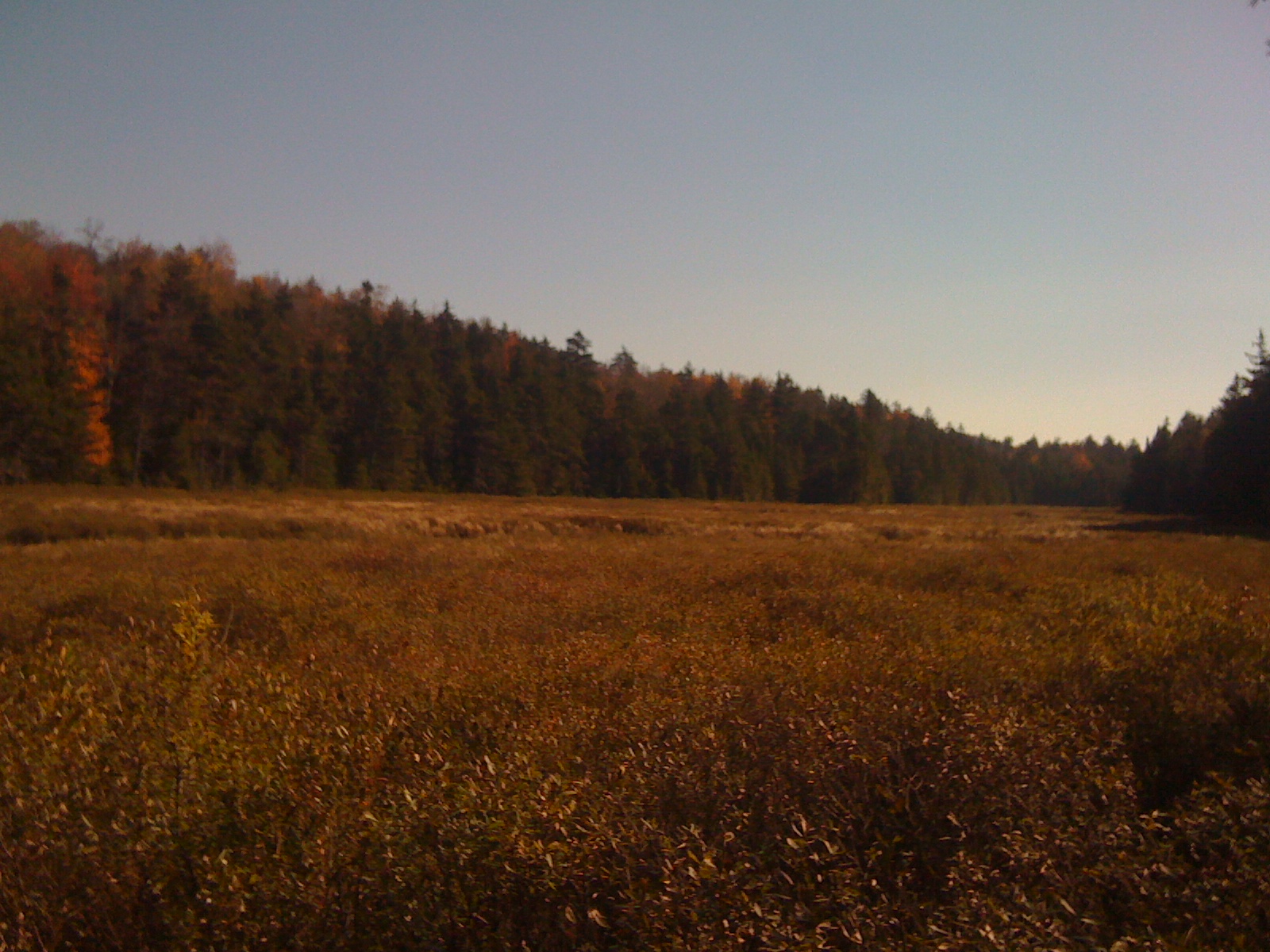 |
| Perfect, I'm alone in prime Bear Country... |
 |
| The biggest horizon line you'll never see from a kayak... |
 |
| And suddenly it becomes clear how multiple people could be deceived by the edge of such a large waterfall and take the fast route down. (The fast route is unadvisable.) |
About a third of the way down, I followed a faint trail to the edge of the waterfall. Backtracking, I followed another faint trail to a steep, moist rock-face that joined up with the bedrock supporting the waterfall. It stuck out, kind of like a step, and it looked like the trail continued on the other side. I passed on this one, and backtracked to the top before descending on a wider switchbacked route. I ended up at the base of one of New York's most impressive waterfalls.
 |
| The Base of T Lake Falls and reflecting fall foliage from far above |

 |
| Oh hey there sunshine... This is probably only about 3/4 of the whole waterfall. |
 |
| Photos of the falls come pre-framed for your convenience... |
 |
| Looking a looong way back up towards the top... At least, that's what my "friend" told me. |
 |
| An offering to the waterfall gods that didn't get thrown over the edge |
Overall, this is an awesome hike not to do. It's not really long and pristine, and it's not an incredible waterfall that most people don't know exists. It's also not really dangerous, or against the law. You should just content yourself to hiking into T-Lake and maybe spending a night at the awful lean-to they have there. Really.
So now that I'm back in the fake empire, I'll leave you with a few lessons I've learned, and a few more I'm still working on.
Lessons I've learned that probably kept me from dying (or just having a really miserable time):
- Tell someone where you're going and when to expect you back, even though it's annoying and your plans will probably change. Keep them updated as much as possible.
- People make a lot of noise. Most smaller animals probably think you're a bear. Making lot's of noise will make bear's think you're a bigger bear with bionic arms (aka scary).
- Make sure you have extra layers for sleepy time, even if you're not cold, they make great pillows.
- Just because an unmarked trail looks like it sees a lot of traffic doesn't mean it's a shortcut, or that it leads to something cool. It usually means that someone had gullible friends.
- It's easier to climb up something than to climb back down. Never climb anything that has a reasonable route around it that you can just walk up. Actually, it's better if you just don't climb.
- Rocks are slippery. Rocks that are wet are really slippery.
- Campfires make everything better
Lessons that I probably should know by now, but never actually pay attention to:
- Parents will worry. Always.
- Not every leaf that rustles outside your sleeping area is a bear. Chillout holmes.
- Camping/Hiking alone isn't a great idea or even that much fun. Find some pals that don't mind a little sweat and enjoy the outdoors responsibly.
- Bushwhacking sucks. Bushwhacking parallel to the trail isn't faster, or more efficient... It's just dumb.
- Seriously, stop climbing shit.
- Mossy logs are slippery too. Wet, mossy logs are really slippery-er than wet rocks.
- Bring more water than you think you need. Dehydration is really, seriously, not-f*cking-around, a big deal. I ran out of water about 1/4 of the way back and was borderline delusional until I broke down and filtered some water through my shirt and into one of the empty water bottles. I may or may not have contracted Giardia, or some other fun waterborne parasite/virus/bacteria/natural killing device.
Subscribe to:
Posts (Atom)



About Me

- Eric
- I am a freelance writer and photographer, collector of experiences, adventure lover, and outdoor goer.
